The New Migration Science
By Scott Weidensaul
April 11, 2017
From the Spring 2017 issue of Living Bird magazine. Subscribe now.
Dawn on the Alabama Coast; the Chuck-will’s-widows are calling in the last of the twilight, but already I can sense a tension in the forest that’s been missing for the past few warm—and essentially birdless—April days at Fort Morgan, a Gulf Coast peninsula that juts out into the eastern side of Mobile Bay.
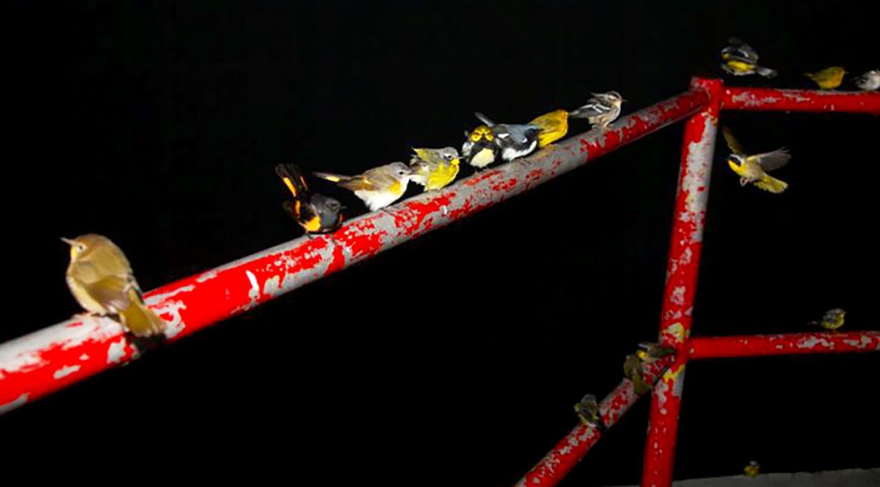
The previous afternoon, though, a cold front swept down from the north, its rain and blustery headwinds slowing the invisible legions of migrants that were completing a 600-mile crossing of the Gulf of Mexico. Instead of a relatively easy flight from the Yucatán Peninsula, these birds had clawed their way through the storms and their windy aftermath. Exhausted and hungry, they piled overnight into the oak and pine forest of Fort Morgan—a fire escape, in the parlance of migration ecology, an emergency pit stop where they could grab a quick bite and a little rest before continuing north.

As the light grew, the woods seethed with birds, a classic Gulf Coast fallout that would make any birder’s life list of red-letter days. I barely knew where to look, and binoculars were almost superfluous; at times warblers all but perched on my hat brim. But the Gulf is more than just a birding hotspot. It is perhaps the single most critical link in the hemispheric chain of habitat that makes bird migration possible.
Ornithologists have long wanted to better understand the dynamics that bring birds here, and exactly how they use this coastal landscape. With migrant populations falling ever lower, the birds’ very survival may hinge on scientists piecing together this puzzle. So it may be just in the nick of time that powerful new tools to study migration have emerged. Rapid advances in computation, miniaturized tracking technology, new laboratory techniques, and big data are all converging to allow ornithologists to study migration at breathtaking scales—not just on the Gulf Coast, but across North America. Soon, these techniques may even permit scientists to flip back through time, on a virtually night-by-night basis, to see how migration and migrant numbers have changed over the decades.
Today is a truly exceptional time for migration science, with so many new avenues for documenting the journeys of birds.
“There are some really big, new frontiers that have been promising for some time, but in the past two or three years we’ve seen advances that finally make it possible to do some things we’ve always wanted to do,” said Andrew Farnsworth, a research associate at the Cornell Lab of Ornithology who is using newly advanced, high-definition radar systems to track migrants. “The future is not that far.”
The results will be far-reaching, however. This research convergence not only provides an unparalleled window into migration. It creates extraordinary new conservation tools that can identify critical bird habitat for preservation and quantify what birders have been saying for years—that migrant populations are in deep trouble.
Every age thinks it’s a gilded one. A hundred years ago, no doubt, ornithologists congratulated themselves on living in a Golden Age of smokeless gunpowder and fine-grade birdshot that made collecting specimens easier. But today really is a truly exceptional time for migration science, with so many new avenues for documenting the journeys of birds.
Tiny Geolocators Map Birds’ Migration Routes
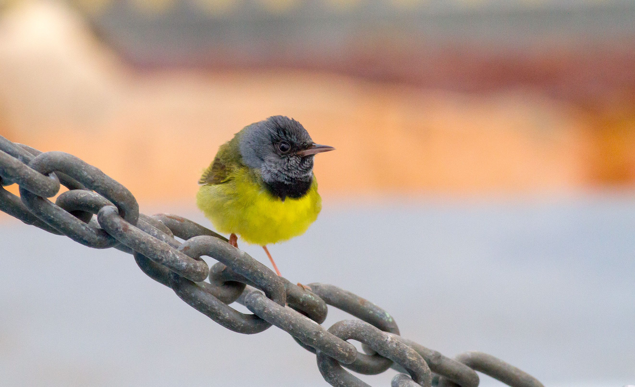
The light is growing in the Alabama woods, and the birds that poured into the coastal strip overnight are becoming more active—warblers, vireos, and many other Neotropical migrants. A flash of brown catches my eye; a Swainson’s Thrush, its breast a muddle of smeared dark spots, its face and throat the warm color of buckskin. Like most of the birds flitting through the trees, it spent winter somewhere in Latin America, maybe Honduras or Colombia, and will nest hundreds or thousands of miles to my north—probably somewhere in Canada or Alaska. But where, exactly?
Until recently, the only way to learn such details would have been with a numbered leg band. My colleagues and I were, in fact, banding migrants in the Alabama woods on this busy morning for a long-running research project. Just five years ago, were we to capture this Swainson’s Thrush and affix a lightweight numbered band on its leg, we would hold out hope that someone—perhaps a fellow bird bander in Manitoba—might one day encounter our banded bird and report its number, like finding a message in a bottle. Banding is still an important tool for ornithologists, but the recapture rate for most songbirds is infinitesimally small, about 1.3 percent.

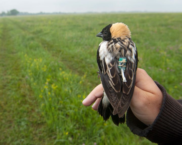
Geolocators on Bobolinks have shown them using multiple sites across their winter range in South America. Photo by Joel Sartore. 
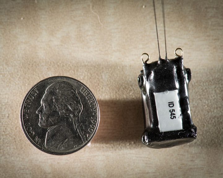
Satellite tags and geolocators are revealing the migratory paths of large songbirds. Pictured is a 3.4-gram GPS Argos satellite transmitter. Photo by Tim Romano.
Today scientists can fit songbirds with tiny data-loggers known as geolocators that weigh a fraction of a gram and record a bird’s rough position throughout migration. Geolocators still require recapture for data download, but they provide more data. I’ve put geolocators on Swainson’s Thrushes in Alaska and recaptured them a year later to find journeys from the tundra of Denali National Park to the jungles of southern Amazonia unspooling in a cascade of data pouring from the miniature device. Other scientists have used geolocators to document Bobolinks chasing seasonal resources across multiple sites in their winter range in South America, and Wood Thrushes wintering in shade-coffee regions in Central America.
Satellite transmitters, which debuted in the 1970s, also do an amazing job of following a tagged animal anywhere on the planet. But they cost thousands of dollars each, and they’re heavy.
“The minimum size for satellite tags is about 3.5 grams,” said Stu Mackenzie, migration program manager for Bird Studies Canada. Generally, researchers limit any tag to no more than 3 or 4 percent of a bird’s mass, meaning even the smallest satellite tag is far too heavy for any bird smaller than a Mourning Dove.
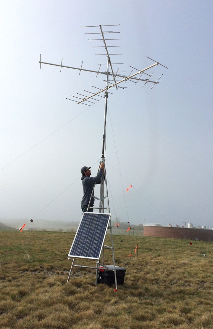
That’s why Mackenzie and others have turned to nanotags—VHF radio transmitters so tiny they can be carried by dragonflies. And to track the nanotags, Bird Studies Canada is spearheading the Motus project, a collaboration among researchers and institutions that has sprinkled receiver stations from the Arctic to South America in a fast-growing array to track nanotagged animals.
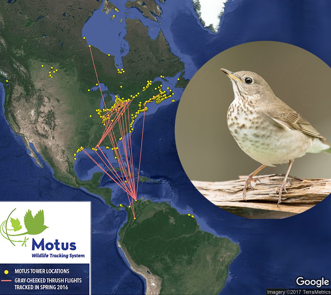
The genius of the Motus network isn’t just that the tags are tiny and the technology relatively cheap. It’s also that all the tags broadcast on the same frequency, to which all the towers are tuned. So any tag, on any organism, can be picked up by any station. The receiver records the time, strength, and direction of the signal, as well as the unique ID pulse embedded within it—like Morse code in the sky, identifying the transmitter as having been placed on, say, a White-rumped Sandpiper in Hudson Bay.
So far, some 100 collaborators have tagged more than 10,000 birds, bats, and insects, Mackenzie said. And the project has erected more than 325 receiving towers. Depending on local topography, each receiver covers an area about 20 miles in diameter.
“We’ve seen incredible growth not just in the Northeast, but down into the southeastern United States,” Mackenzie said. “An array around the Gulf of Mexico is taking shape, down into Central and South America, with nodes in the high Arctic, sub-Arctic, and the central prairies, and starting on the Pacific coast. The dots are beginning to fill in.”
Motus has already paid big dividends on hard-to-study aspects of avian biology. Since 1963, for instance, more than 3,100 Swainson’s and Gray-cheeked thrushes have been banded on their Colombian wintering grounds, yet only six were ever encountered again. By contrast, 14 of the 36 gray-cheekeds fitted with nanotags in Colombia were tracked as they moved across North America in 2015, including one bird that flew more than 2,000 miles from South America to Indiana in just over 3 days.
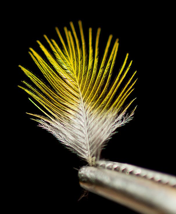
Other big breakthroughs in migration tracking don’t require any kind of tag at all. High-resolution genetic markers, teased out of the DNA in skin cells at the base of a feather quill, are helping scientists determine from which of many widely scattered breeding populations a migrant warbler may have come. And isotope analysis of a single feather plucked from that Swainson’s Thrush passing through the Alabama woods can tell scientists whether it originated in Alaska or Pennsylvania.
As birds eat and drink, they consume rare forms of hydrogen, known as isotopes, which vary in their number of neutrons. Deuterium, an isotope of hydrogen, is more abundant at the equator than at the poles, so the ratio of deuterium to hydrogen isotopes in a feather indicates where in the north that bird was when it grew that feather.
“We now have an opportunity to integrate what we learn from these technologies to take our understanding to new scales,” Farnsworth said. “We’re in a new age of observation where we’re assembling an ever more complete picture of birds’ life cycles in space and time. More and better science and knowledge will translate into more and better conservation action.”
Radar: The First Tool in Understanding Migration Patterns
The sun was rising higher, and the Alabama woods were quieting down. Having sated themselves with insects, many of the newly arrived migrants were resting, because come nightfall they would take off once more. The vast bulk of migration occurs after dark, which is why migration has always been hard to study. In the 1940s, the best technique available to scientists was staring at the face of a full moon through telescopes to try to count the silhouettes of passing birds.
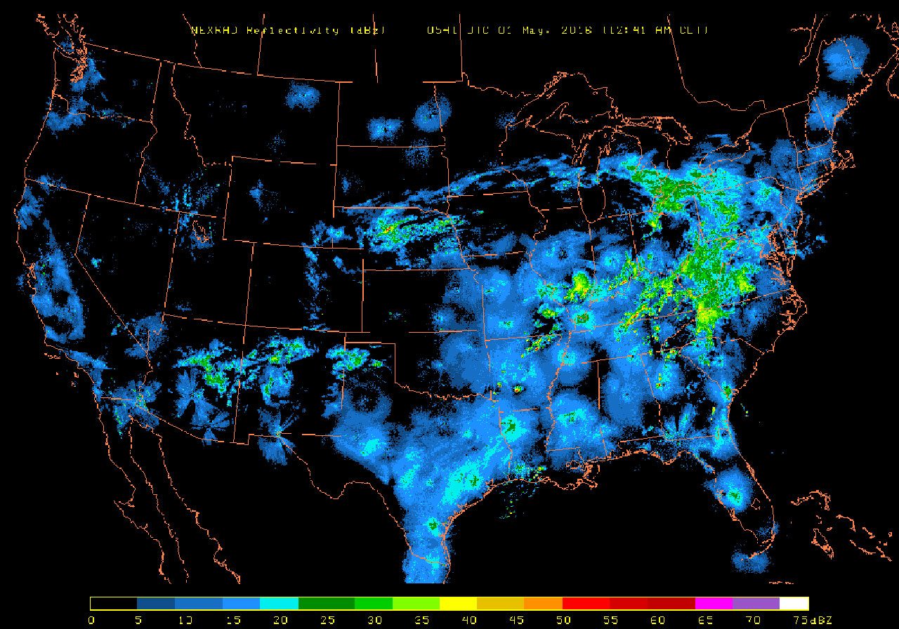
Radar allowed scientists to peel back the curtain of darkness and see, at least crudely, how birds were moving through the night sky.
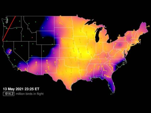
The advent of radar allowed scientists to peel back the curtain of darkness and see, at least crudely, how birds were moving through the night sky. Radar was originally a military technology that came of age during World War II, later refined for weather forecasting. Beginning in the 1950s, it was adopted by ornithologists. The development of the NEXRAD Doppler system in the 1990s revolutionized radar ornithology, giving dramatically more detail on the movements, speed, and density of bird flocks aloft, which appeared as diffuse blobs of blue or green on a radar screen.
Piecing those blobs together, though, can be a labor-intensive job, as Farnsworth knows. He was one of the original scientists in the BirdCast project, a joint effort by the Cornell Lab, National Audubon, Clemson University, and other partners to predict bird migration movements via radar, like a weather forecast for birds. Back in 1999 it took Farnsworth hours every morning to manually process 10 individual radar scans and stitch them together to create a single snapshot of migration at a single moment the night before.
An explosion in computing power, and far more sophisticated algorithms, have dramatically changed that picture. Today Farnsworth can assess every radar scan from 16 stations in the northeastern U.S. in just a few minutes. He and his colleagues can quickly process data from more than 1,000 individual radar scans, create a tapestry of nocturnal movement through the night, and quantify the avian biomass aloft across an entire region. Where nanotags allow researchers to track a single bird, radar allows them to see millions at a time.
And if researchers want to zero in on a single bird among the masses in a radar scan, the latest technology allows them to do that, too. Today’s dual-polarization radar, which sends out two microwave beams instead of one, was designed to allow meteorologists to see the size and shape of precipitation inside storms—raindrops versus hail versus snow, for example. Radar ornithologists have embraced dual-pol capabilities because it allows them to see details on migrants—like which way a bird’s beak is pointing.
“Because of its ability to resolve the spatial arrangement of targets in the atmosphere, [we can ask whether] birds are pointed in the same direction they’re moving,” Farnsworth said. Along those lines, a team that included Cornell grad Benjamin Van Doren (now at Oxford University), Kyle Horton at the University of Oklahoma, Farnsworth, and others recently used dual-pol radar to show how nocturnal migrants sometimes angle their heading into crosswinds to compensate for wind drift, like a sailor angling across the sea breeze—a critical ability for migrants, but one that previously had been almost impossible to study.
But nocturnal migration is only part of the story. In many ways, the most critical component in a bird’s global movements are the way stations where it feeds and rests—stopover habitat like this coastal forest in Alabama. And here, too, radar is giving conservationists a penetrating new way of seeing the world from a bird’s perspective.
Jeff Buler, the director of the University of Delaware’s “Aeroecology” Program, is using the very lowest beam of NEXRAD radar to catch birds just as they leave the ground for their nighttime flight—and thus identify the small patches of habitat where they’d spent the preceding day.
This new radar technique is allowing conservationists to zero in on patches of habitat as small as 25 acres that harbor large numbers of birds. Radar and other remote sensing, for example, allowed Buler and other scientists to see how migrants responded to the habitat destruction wrought by Hurricane Katrina in 2005. In the weeks following the storm, birds abandoned the bottomland swamp forests that were stripped of their foliage and shifted to intact pine uplands, normally marginal habitat for migrants. But the birds returned when the lowland forests recovered.
“As the greenness of the [lowland] forest returned to normal, the density of birds returned to normal,” Buler said. One of his grad students is now combing back through the radar archive to see how migrants have responded to other hurricanes in the past.
This kind of time travel is one of the most enticing possibilities posed by radar analysis. Scientists like Buler and Farnsworth have access to an archive of half a billion individual Doppler radar scans, dating back more than two decades—“a gold mine,” as Buler calls it. With faster processing speeds, it’s possible for scientists to translate ever-bigger chunks of that archive into migratory data, allowing them to look back in time to see how migration patterns and populations have changed.
Perhaps not surprisingly, the news so far isn’t good. Buler’s lab analyzed 12 years’ worth of radar data for North Carolina and discovered that the number of autumn migrants dropped by 27 percent during that period. Now his team has done the same thing for the Northeast, in a soon-to-be-published study looking back at a seven-year span.
“In the fall we saw a decline of 29 percent in bird densities, a decline of 4 percent a year in migrant biomass in the Northeast,” Buler said. It provides solid evidence to back up what the Breeding Bird Survey has long suggested, that migrant populations are in trouble at a broad scale. And in very broad timelines, too, since Buler and his colleagues can go back and see how migrant trends have changed for decades.
“I don’t think we even appreciate all the questions we can ask” using the radar archive, Buler said. “This is one of the most important biological datasets anywhere, and it’s been largely untapped. There’s so much information in there. Insects. Roosting bats. The phenology of Purple Martin migration. We’re just cracking it open right now.”
Together, Scientists Learn the Mysteries of Migration
To really crack open what the radar archive can tell us, Farnsworth and Buler have teamed up with a number of other researchers—including isotope expert Emily Cohen from the Smithsonian Migratory Bird Center and Cornell University computer statistician Daniel Fink—in a convergence of the powerful new techniques for studying bird migration. While Buler is using radar to plot stopover sites and migrant density, and Farnsworth and the Cornell team are tracking millions of birds in the night sky and through birders’ observations, Cohen is using isotopic signatures in feathers and toenails from birds captured at banding stations to look at population structures and migration timing. Together, they are training their expertise on the north shore of the Gulf of Mexico—arguably the most critical region for bird migration in the entire Western Hemisphere.
Learn More About Migration
“The idea, if we can do it, is to characterize the flux of migrants into the U.S. How it changes each year. How that relates to climatology,” Farnsworth said. “We’re planning to look backwards through the archive all the way to the beginning of [the NEXRAD system], so we’re talking about more than two decades’ worth of data.”
Cohen and her colleagues have already found that different breeding populations of American Redstarts and Wood Thrushes pass through the Gulf at different times in spring, with southern birds arriving earlier than northern breeders. Among redstarts, there were also clear patterns in when different age and sex classes migrate through. But not among the thrushes, where young and old, males and females, “just all kind of move at once,” Cohen said. That information is critical to understanding, for instance, how short-term threats like hurricanes might impact migrants from different regions.
Fink is using eBird, the big-data engine of hundreds of millions of observations from birders, to add another crucial piece to the Gulf project—species identification. Because while radar may now be able to distinguish the head of a bird from its tail, it can’t identify the species. It is, in Farnsworth’s phrase, “taxonomically agnostic.”
That’s where eBird checklists come in, painting an incredibly detailed picture of species-level migration through the region—taking the sweeping outlines of the radar data and suffusing it, as it were, with the colors of Cerulean Warblers, Yellow-billed Cuckoos, Indigo Buntings, and hundreds of other migrants large and small.
Unlike the nocturnal, aerial radar data, “these observations are made on the ground, and most of them are diurnal,” Fink said.
And, he says, they include on-the-ground habitat data. For example, a team that included Fink found that during autumn migration a large number of forest-nesting songbirds seem to be found in landscapes modified by humans, including urban areas. Look at the models for Wood Thrush, Fink said, “and what you see as fall comes in is that the deciduous forests decline [in importance] and the cities light up [with birds.] You see this urban footprint emerge. Something’s happening in migration, but what’s the process?”
That might seem like a hiccup in the eBird model. Surely Wood Thrushes favor woodland habitats over cities. But radar studies show the same phenomenon in autumn, and Jeff Buler thinks he knows why: urban lights.
“It seems that migrants are showing an attraction to the sky-glow of big cities,” Buler said. “We know this happens at a very fine scale, like the 9/11 memorial in New York, where they get attracted and trapped in the lights, but they also seem to be exhibiting this very broad-scale attraction to cities.”
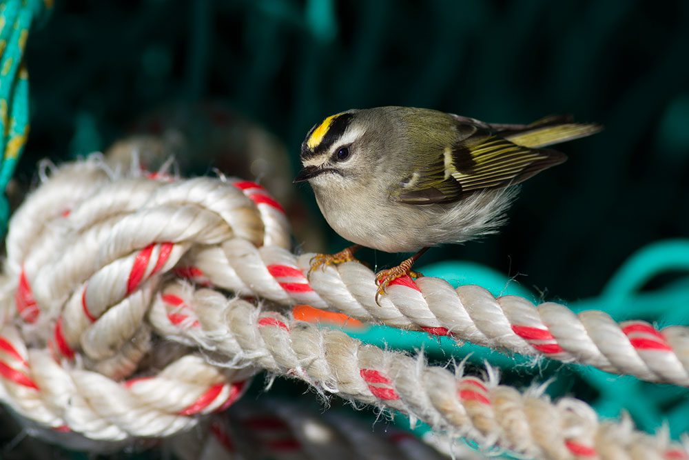
Urban parks, he notes, report some of the highest densities of migrants anywhere, a finding once assumed to be a bias caused by lots of urban birders. In fact, those reports may reflect a very real phenomenon with real consequences for tired, hungry migrants lured to cities, where quality stopover habitat is scarce and millions of migrants die each year in collisions with glass-covered buildings.
Ever the opportunist, Andrew Farnsworth sees a way to use urban light pollution to his advantage, to illuminate and tally birds in migration. And to do so, he’s been experimenting with a very old-school technology—inexpensive closed-circuit cameras, like the security cam in a grocery store. In a pilot project, Farnsworth installed such a cam outside his New York City apartment window and “collected some really cool data on height, speed, and direction of bird flight in the city.”
Farnsworth says cams installed at strategic points along migratory routes near big cities that are well-lit could allow for bird detection up to a kilometer and a half away, “maybe more.” It would be “awesome,” he says, to deploy them on brightly illuminated drilling rigs in the Gulf.
But the real grail for migration scientists still lies just around the corner—a unified method of quantifying birds overhead (as radar can do) and also identifying them (which radar can’t). The way to do both could involve sound, not sight—acoustic monitoring—and it’s what really gets Andrew Farnsworth excited.
It does feel like a golden age, but it’s also really urgent. You have to wonder, are we going to be able to draw these big syntheses in time, while these birds are still common?—Emily Cohen
The Cornell Lab has been recording and analyzing the nocturnal flight calls of migratory birds since the 1980s, but in many respects it’s a technique stuck where radar was a few years ago—full of promise, but tedious and immensely labor-intensive to process data into something meaningful. Five years ago, it would have taken a human being 12 years of 24/7 continuous listening to analyze the millions of night flight calls collected by the Cornell Lab.
Now a large National Science Foundation grant is underpinning a fresh round of development at the Cornell Lab, and Farnsworth expects the same quantum leap in computing ability and automation in acoustics that occurred with radar. He predicts a day in the near future when citizen scientists, who have been contributing bird count data from their backyard feeders for decades, will be able to contribute night-call data, too.
“Put a microphone out your window, run an algorithm [on your computer], and in the morning, you have a histogram with the number of calls and the species of callers. And you’ll do that not just for a single site, but an entire region or across the country,” he said. “That’s gonna happen in five years. It’s an unimaginable leap. It opens a whole new realm of information at a huge scale. There’s no other technology that can do what acoustics can do, on the scale of a continent, to tell us what species are migrating.”
There’s no doubt it’s an exciting time, but for Farnsworth and all the other scientists working to unlock the mysteries of migration, there’s a definite feeling of time slipping away.
“It does feel like a golden age, but it’s also really urgent,” Emily Cohen from the Smithsonian said. “You have to wonder, are we going to be able to draw these big syntheses in time, while these birds are still common?”
Scott Weidensaul is a naturalist and Pulitzer-nominated author of more than two dozen books about natural history.

All About Birds
is a free resource
Available for everyone,
funded by donors like you
American Kestrel by Blair Dudeck / Macaulay Library
