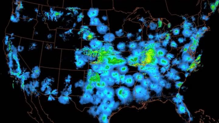
Can you really use weather radar to see migrating birds?

It’s true. Weather radar images show where radar beams have been “reflected” as they sweep the atmosphere. They’re useful for showing weather conditions because the beams are reflected by precipitation and the water vapor in clouds, but they can also be reflected by swarming masses of birds or insects.
In the early days of World War II, British radar operators noticed mysterious, ethereal shadows drifting across their screens. They weren’t associated with weather systems and so the radar technicians nicknamed them “angels.” In 1958, a New Orleans high school student named Sidney Gauthreaux, realizing that these “angels” were really the radar reflections of swarms of birds, started scrutinizing radar images. As a Louisiana State graduate student, he worked with radar images to document the existence of massive trans-Gulf migrations. In the late 1980s, Gauthreaux started examining archival radar images and made a disturbing discovery: major bird movements over the Gulf had declined by nearly half since the 1960s.
Next Generation Radar (NEXRAD) made studying bird migration much easier. The Air Force started using it to avoid collisions in their Bird Aircraft Strike Hazard program. Graduate students took stunning images of giant expanding aerial doughnuts, which they found to be thousands of Purple Martins radiating from critical roosting sites each morning. Now it’s easy for anyone with access to a NEXRAD weather map on their computer to see birds take off on migratory movements at night or alight in the morning, if you know how to interpret the mystifying patterns. You can learn how at Gauthreaux’s website at Clemson University.

All About Birds
is a free resource
Available for everyone,
funded by donors like you
American Kestrel by Blair Dudeck / Macaulay Library
